The Revenge of Seargent Major Splat-Pudding !!!!!, 22 miles, Monday 1st January 2018, Route: (view, download), Photographs, Details
The Revenge of Seargent Major Splat-Pudding !!!!!, 22 miles, Monday 1st January 2018, Route: (view, download), Photographs
Changes: Please note that the walk now starts in Penderyn and not in Ystradfellte as advertised in Strider, this is due to the recent weather conditions affecting roads in the area, see Programme for latest walk location details
Meet/Start time : 08:30. At: Parking in a lay-by on the A4059 just up from the Distillery, SN951084
Description: A walk taking in the remote area's surrounding Ystradfellte, Penderyn and the Hepste.
Grid reference(s):Meet: SN 951 084, Start: SN 951 084
Meet/Start time : 07:00. At: Palmer Community Centre, Place de Cormeilles, Chepstow, NP16 5LH , ST533938
Description: An exciting winter kanter with a 'twist' in the beautiful Wye Valley on the Wales / England border. The event uses established long distance routes such as Offa's Dyke, Wye Valley Walk and Gloucestershire Way as well as paths to link main routes. This event provides a choice of four routes where clues need to be gathered. The twist is this: If you do not have the confidence to self-navigate, then gpx tracks and route descriptions will be provided to enable you to walk the route of your choice. You will still need to answer the clues to earn a certificate! There will be NO checkpoints on the routes and entrants will need to ensure that they have sufficient food and drink for their chosen route.
The South Wales LDWA will supply a substantial hot meal and hospitality on your return to Chepstow. Tea and toast provided at the start.
Notes: AN EVENT MANAGED BY THE SOUTH WALES LDWA COMMITTEE, FAMILY & FRIENDS FOR SOUTH WALES LDWA MEMBERS AND OTHER GUESTS. THIS EVENT WAS OVERSUBSCRIBED IN 2017. EARLY ENTRY RECOMMENDED.
Enter here
£6 for LDWA members
Grid reference(s):Meet: ST 533 938, Start: ST 533 938
No Boots Required Again, 15 miles, Saturday 10th February 2018, Route: (view, download), Photographs
Meet/Start time : 09:00. At: Risca Leisure Centre car park, ST260901
Description: A semi-urban walk to Tredegar House via Mescoed Wood, Allt yr yn and the Gaer. Returning through Rhiwderin and Fox Wood. Tea/coffee stop at Tredegar House for lunch.
Grid reference(s):Meet: ST 260 901, Start: ST 260 901
2020 Hundred Recce: Usk to The Queens Head, 20 miles, Saturday 17th February 2018, Route: (view, download), Photographs, Details
2020 Hundred Recce: Usk to The Queens Head, 20 miles, Saturday 17th February 2018, Route: (view, download), Photographs
Meet/Start time : 08:00. At: Meet at the Queens Head Car Park on the Llanthony Rd. There is a charge of £2 for the carpark, SO3109822137
Description: Walking from Usk to the Queens Head on the 2020 Hundred.
Notes: Meeting at the Queens Head Car Park in the Black Mountains, we drive down to Usk (A4042 to Little Mill, then A472 to Usk) and walk back to the Queens Head.
Grid reference(s):Meet: SO 31098 22137, Start: SO 37610 00777, Finish: SO 31098 22137
Changes: -- Please note that if the weather is bad the walk won't go ahead.
Meet/Start time : 09:00. At: Meet in Pontrhydfendigaid at the Recycle Bin., SN729662
Description: Walking from Pont, up onto Banc Gwyn and down into Strata Florida, up onto Garn Gron and into the Carn Flur Forest. Some rugged ground after Garn Gron. From the Forest we head back toward Strata Florida to ascend up onto Disgwylfa, Llyn y Gorlan and Llyn Egnant to the bothy. -- Please note that if the weather is bad the walk won't go ahead.
Notes: There are around 7 places on the walk, once the places are filled up a message will be displayed informing you that the walk is full. If you are willing to camp outside the bothy then this will be fine for you to join the walk.
Grid reference(s):Meet: SN 729 662, Start: SN 729 662
Meet/Start time : 09:00. At: From Claerddu bothy., SN792686
Description: Day two see's us ascend up onto Dibyn Du and across to Crug Gynon and over the wild rugged hills thereon to a bridleway that leads us to the Lon Las Cymru byway. We follow this byway for a while and cross over a ridge called Pen yr Bwlch into Cwm Myro and into Strata Florida and back to Pontrhydfendigaid.
Notes: A wild walk which traverses large tracts of open moorland with some wet area's. I've made the most of the ATV & sheep tracks to make the going a little more easier underfoot. There are several stream crossings, while they don't require getting your feet wet, they will require a good - 'rucksack-less' leap to make good the crossing.
Grid reference(s):Meet: SN 792 686, Start: SN 792 686
Cancelled – The bog and beacon, 18.5 miles, Saturday 3rd March 2018,
Location, Details
Cancelled – The bog and beacon, 18.5 miles, Saturday 3rd March 2018,
Location
Changes: The walk has been cancelled due to the severe weather conditions
Meet/Start time : 09:00. At: Whitestones car park, near Llandogo/Tintern, SO525029
Description: A meander through some familiar and less visited parts of Monmouthshire. The route takes in Cleddon, Beacon Hill, Trellech, Cwmcarvan, Croes Robert, Woolpitch Wood, Llanishen, Catbrook and Ninewells Wood.
Notes: The meeting point is the picnic area around 200 metres from the road - do not park in the few car spaces immediately after you turn off the road, the meeting point is further on.
Grid reference(s):Meet: SO 525 029, Start: SO 525 029
Cancelled – The Monmouthshire Way Part 5, 18 miles, Saturday 17th March 2018,
Location, Details
Cancelled – The Monmouthshire Way Part 5, 18 miles, Saturday 17th March 2018,
Location
Meet/Start time : 08:00. At: Public Car Park (Free) Penperlleni Village, SO322046
Description: The fifth of seven walks of the Monmouthshire Way, a walk designed by David Morgan that explores the ancient county of Monmouthshire. Visiting Whistle Inn, Coity Mountain, a brief foray into Blaenau Gwent, Pontypool Park, Folly Tower, Monmouthshire and Brecon Canal and finishing in Penperlleni. The walk will commence at Keepers Pond and finish at Penperlleni. 2800 ft ascent.
Notes: Members to book themselves onto the minibus. Once spaces are filled, then members will have to make their own car sharing arrangements.
Grid reference(s):Meet: SO 322 046, Start: SO 254 107, Finish: SO 322 046
Wye Not ?, 12 miles, Wednesday 21st March 2018,
Location, Details
Wye Not ?, 12 miles, Wednesday 21st March 2018,
Location
Meet/Start time : 00:00. At: Erwood Station Craft Centre & Cafe Car Park, SO08704395
Description: A spring walk in the picturesque mid Wye Valley taking in local points of interest. The route is on tracks & paths along the Wye river & tributary streams, in woodland & on gentle hills.
Notes: The usual layers & waterproofs for the time of year.
Grid reference(s):Meet: SO 0870 4395, Start: SO 0870 4395
The Monmouthshire Way Part 6, 19 miles, Saturday 24th March 2018, Route: (view, download), Photographs
Meet/Start time : 08:30. At: Foresters Oaks Car Park, Wentwood, ST429939
Description: The sixth of seven walks of the Monmouthshire Way, a walk designed by David Morgan that explores the ancient county of Monmouthshire. Visiting Usk Valley Way, Usk, Bertholey, Wentwood Gate and finishing at Foresters Oaks Car Park. The walk will commence at Penperlleni and finish at Foresters Oaks Car Park, Wentwood.
Notes: Members to book themselves onto the minibus. Once spaces are filled, then members will have to make their own car sharing arrangements.
Grid reference(s):Meet: ST 429 939, Start: SO 322 047, Finish: ST 429 939
Fforest Fawr Spring Loosener, 32 miles, Saturday 31st March 2018, Route: (view, download), Photographs
Meet/Start time : 08:00. At: Car-park on A470 opposite Storey Arms Centre, SN983203
Description: Limber up for spring with a big walk taking in first the peaks of the Fforest Fawr region, then the low-lands, forests and waterfalls south of Ystradfellte, and finally finishing on Fan Fawr. A challenging walk including some tough off-path walking.
Notes: Please bring suitable kit for winter-walking in the Beacons and a head torch as likely to finish at dusk
Grid reference(s):Meet: SN 983 203, Start: SN 983 203
The Monmouthshire Way Part 7, 16 miles, Sunday 8th April 2018, Route: (view, download), Photographs
Meet/Start time : 08:30. At: Chepstow Leisure Centre Car Park, ST529943
Description: The seventh of seven walks of the Monmouthshire Way, a walk designed by David Morgan that explores the ancient county of Monmouthshire. Visiting Gray Hill, Carrow Hill, Slade Woods, Rogiet and the Wales Coast Path to finish in Chepstow. The walk will commence at Foresters Oaks Car Park and finish in Chepstow.
Notes: Members to book themselves onto the minibus. Once spaces are filled, then members will have to make their own car sharing arrangements.
Grid reference(s):Meet: ST 529 943, Start: ST 429 939, Finish: ST 529 943
My Birthday Walk, 37/18 miles, Saturday 21st April 2018, Route: (view, download), Photographs
Changes: 37 miles = 60 km
Meet/Start time : 07:00. At: Meet at Byefield Lane Car Park, Abergavenny., SO297141
Description: A circular walk visiting places dear to my heart. Come along and I'll explain as we go.
Option 1) Part circuit. Walk to Crickhowell via Blorenge and the lonely shepherd then catch the bus back. 18 miles & 3300' ascent.
Option 2) The complete circuit. As option 1 plus Pen Allt Mawr and the Sugar Loaf. 37 miles & 7700' ascent.
Notes: Buses from Crickhowell are circa one hour intervals and a single fare costs £1.85 as at 21/02/2017.
Grid reference(s):Meet: SO 297 141, Start: SO 297 141, Finish: Invalid
Meet/Start time : 08:30. At: In Blackmill turn in at the war memorial and garage. Just past the garage turn right and then left over the river bridge into free car park., SS933867
Description: A walk up the Llynfi valley, dropping into the Garw valley and up onto Mynydd Llangeinor and down to the Ogmore valley on the way back to Blackmill.
Grid reference(s):Meet: SS 933 867, Start: SS 933 867
Meet/Start time : 00:00. At: Meet at Skenfrith Castle, SO457203
Description: Starting at Skenfrith Castle passing the ancient church of St Bridget's, consecrated in 1207, we follow the waymarked route clockwise to White Castle and Grosmont
Grid reference(s):Meet: SO 457 203, Start: SO 457 203
Description: First leg of the impressive route used for the SW100 via the Taff Trail, via Castell Coch, west over Garth Hill, the Ridgeway Walk to Llantrisant and Mynydd y Gaer. North to cross Ogwr Fach and Glynogwr. Finally Mynydd William Meyrick to finish in Ton Pentre and catch return train to Radyr.
Notes: Walk expected to take 10 hours. Individual train ticket costs £4.50. Group ticket will be cheaper.
Grid reference(s):Meet: ST 134 804, Start: ST 134 804, Finish: SS 972 953
Social Weekend Away North Wales, 17 miles, Saturday 30th June 2018,
Location, Details
Social Weekend Away North Wales, 17 miles, Saturday 30th June 2018,
Location
Meet/Start time : 09:00. At: Meet at the parking in Gelli just outside of Capel Curig, SH7202258309
Description:
Walking out to the remote Cwm of Cwm Eigiau via the localised hills, crossing the dam at Llyn Colwyd Reservoir to enter Cwm Eigiau. we then climb out to Carnedd Llewelyn and descend to Ffynnon Llugwy Reservoir to Helyg and follow a byway back to Gelli
Notes: There is 4900ft of climbing with some rough rugged terrain encountered around the Carneddu area. Accommodation is found at a Hostel in Capel Curig called Plas Curig, there are other places, and booking is available via their website "http://snowdoniahostel.co.uk/tariff_and_bookings.html"
Grid reference(s):Meet: SH 72022 58309, Start: SH 72022 58309
Social Weekend Away North Wales (Carneddau East), 14 miles, Saturday 30th June 2018,
Location, Photographs, Details
Social Weekend Away North Wales (Carneddau East), 14 miles, Saturday 30th June 2018,
Location, Photographs
Meet/Start time : 09:00. At: Chapel Curig-post office, SH720581
Description: Exploring a less visited part of the Carneddau following a varied route over a series of small peaks with superb views of familiar western hills. In brief the route ascends to Crimpiau, Craig Wen & on to the summit of Creigiau Gleision from there it descends to Lyn Cowlyd Dam & begins to return via Pen y Graig Gron to the Crafnant valley back to Capel Curig.
The terrain is a mix of paths, some indistinct, moorland, bog, forestry tracks, heather & rough bumpy grass.
Grid reference(s):Meet: SH 720 581, Start: SH 720 581
South Wales 2000 Ft Mountains Part 1, 20 miles, Saturday 7th July 2018, Route: (view, download), Photographs
Meet/Start time : 09:00. At: Beaufort Street Car Park, Crickhowell (Pay & Display) (£3.20 on 05.01.18), SO219184
Description: The first of a series of walks that will visit all 35 listed 2000 Ft mountains of South Wales. This walk will visit 7 of the listed mountains.
Notes: 3845 ft Ascent and route on paths throughout.
This is a mountain walk. Attendees to ensure that they have appropriate safety equipment and clothing. High level all day.
Grid reference(s):Meet: SO 219 184, Start: SO 219 184
South Wales Hundred. Part two: Pentre to Storey Arms, 24 miles, Saturday 14th July 2018, Route: (view, download), Photographs, Details
South Wales Hundred. Part two: Pentre to Storey Arms, 24 miles, Saturday 14th July 2018, Route: (view, download), Photographs
Meet/Start time : 08:30. At: Storey Arms Car Park. , SN982203
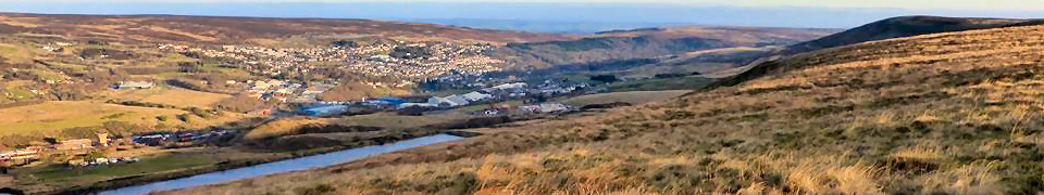
Description: Part two of the SW100. From Pentre, climb to Mynydd Maerdy, cross Mynydd Bwllfa to cross the Heads of the Valleys Road at Hirwaun. Into Waterfall Country via Penderyn to reach Ystradfellte. Then to Blaen Llia to follow the Beacons Way over Fan Llia, Fan Dringarth and onto Craig Cerrig-gleisiad before reaching Storey Arms.
Notes: Minibus to Pentre. Names to Rod Hollands. When the bus is full, anyone else wanting to go will have to arrange car sharing.
Grid reference(s):Meet: SN 982 203, Start: SS 969 961, Finish: SN 982 203
South Wales 2000 Ft Mountains Part 2 – Abandoned Due to Weather, 25 miles, Sunday 29th July 2018,
Location, Details
South Wales 2000 Ft Mountains Part 2 – Abandoned Due to Weather, 25 miles, Sunday 29th July 2018,
Location
Meet/Start time : 08:00. At: Llanthony Priory Car Park (Free), SO289278
Description: The second of a series of walks that will visit all 35 listed 2000 Ft mountains of South Wales. This walk will visit 5 of the listed mountains.
Notes: 5087 ft Ascent and route on paths throughout. This is a mountain walk. Attendees to ensure that they have appropriate safety equipment and clothing. High level most of the day.
Grid reference(s):Meet: SO 289 278, Start: SO 289 278
Hidden Heart of the Wye, 24 miles, Saturday 4th August 2018, Route: (view, download), Photographs
Meet/Start time : 08:00. At: Whitestones car park, near Llandogo/Tintern, SO525029
Description: An exploration of the Wye Valley and its western surrounds via some lesser used paths taking in Llandogo, Cuckoo Wood, Pwllplythin, Wood, Trelleck Comon, Penallt, Cwm-bychan, Trellech and Cleddon.
Notes: The meeting point is the picnic area around 200 metres from the road - do not park in the few car spaces immediately after you turn off the road, the meeting point is further on.
Grid reference(s):Meet: SO 525 029, Start: SO 525 029
The Pools of Painscastle, 25 miles, Saturday 11th August 2018, Route: (view, download), Photographs
Meet/Start time : 08:00. At: Meet in Painscastle in the small gravel lay-by on the north side of the B4594. Do not park in the hall car park., SO165464
Description: A tough circular walk visiting many of the Mawn Pools north of Painscastle. Very little road walking and plenty of big open spaces.
Notes: The walk will involve very close to 5000' of ascent so this is borderline grade B/A. I will most probably camp nearby the night before and after if anyone wishes to join me.
Grid reference(s):Meet: SO 165 464, Start: SO 165 464
South Wales Hundred. Part 3: Storey Arms to New Tredegar, 25 miles, Saturday 18th August 2018, Route: (view, download), Photographs, Details
South Wales Hundred. Part 3: Storey Arms to New Tredegar, 25 miles, Saturday 18th August 2018, Route: (view, download), Photographs
Meet/Start time : 08:00. At: Station Row Car Park, New Tredegar, SO142032
Description: Part three of the SW100. Leaving the Storey Arms climb to cross the central Beacons and on to Carn Pica. Descend to Talybont Reservoir Dam and then climb Mynydd Tor y Foel. Then south to cross the flank of Mynydd Llangynidr and on to reach Trefil. Then over Rhymney Hill and on to Mynydd Bedwellte and downhill to New Tredegar.
Notes: Minibus to Storey Arms. Names to Rod Hollands. When the bus is full, anyone else wanting to go will have to arrange car sharing.
Grid reference(s):Meet: SO 142 032, Start: SN 982 203, Finish: SO 140 032
Down By The Seaside, 50 miles, Friday 24th August 2018, Route: (view, download), Photographs
Meet/Start time : 19:00. At: Chepstow Leisure Centre Car Park (free)., ST529943
Description: A new route from Abergavenny to Chepstow. Following on from the success of "Travelling Riverside Blues", here is another opportunity to walk across the county.
A late evening / night time exploration of the Black Mountains, then to Usk and a return to Chepstow along the Usk Valley, Wentwood and the coast arriving back in Chepstow between 4pm and 6pm. Walk has 7235 ft of climbing.
Notes: Replenish in Usk after 25 miles. Walkers to take personal responsibility should they need to leave the walk by arranging to get themselves back to Chepstow. Contact David Morgan to book space on bus. Non South Wales LDWA members £5. The walk will finish at a pub in Chepstow and have a meal. It is perfectly feasible for members to use the train to reach Chepstow and to let the train take the strain at the end of this long walk!
A Near Full Moon expected.
Grid reference(s):Meet: ST 529 943, Start: SO 297 141, Finish: ST 529 943
Down By The Seaside continued, 25.6 miles, Saturday 25th August 2018,
Location, Details
Down By The Seaside continued, 25.6 miles, Saturday 25th August 2018,
Location
Meet/Start time : 07:00. At: Maryport Street North Car Park (Free), SO376007
Description: Continuation of the walk that started the previous evening in Abergavenny and will finish in Chepstow passing through Usk on route. Opportunity for others to join walk at Usk but will have to make own arrangements to either car share from Chepstow or use bus to return to Usk. The walk will finish at a pub in Chepstow and have a meal.
Notes: Walk will leave Usk at 7am from Maryport Car Park.
Bus 63 leaves Chepstow to return to Usk at 1750 Hrs and 1915 Hrs.
3437 ft ascent.
Grid reference(s):Meet: SO 376 007, Start: SO 376 007, Finish: ST 529 943
Changes: A late addition to the Walks Programme. The gpx file of the route is available for viewing and/or downloading.
Meet/Start time : 08:00. At: Keeper's Pond (Pen-ffordd-goch pond) car park just off the B4246 Blaenavon to Abergavenny road., SO25481074
Description: Heads west via Waun Wen and Black Rock to the Lonely Shepherd Stone. Then to Crickhowell via the eastern end of Mynydd Llangatwg. To Llangenny, round the Sugar Loaf to the river Usk. Around and over the Blorenge back to Keeper's Pond.
Notes: Modified repeat, with reduced ascent, of a walk held in 2009. About 4300 feet of ascent.
Grid reference(s):Meet: SO 2548 1074, Start: SO 2548 1074
As wild as the long-maned ponies, 22.2 miles, Saturday 22nd September 2018, Route: (view, download), Photographs, Details
As wild as the long-maned ponies, 22.2 miles, Saturday 22nd September 2018, Route: (view, download), Photographs
Meet/Start time : 08:00. At: Byefield Lane Car Park, Abergavenny, SO297141
Description: A tour of most of Abergavenny's near-by summits taking in Deri, Sugarloaf, Twyn y Gaer, Bryn Arw and both of the Skirrids. It will be a day of ups and downs with approx 5500 ft of ascent. Based on the first loop of Jason's Deep in the Black Stuff from 2014.
Grid reference(s):Meet: SO 297 141, Start: SO 297 141
Lake District Trip Day 1, 18.3 miles, Saturday 22nd September 2018, Route: (view, download), Photographs
Meet/Start time : 08:30. At: Based on the town of Keswick., NY266232
Description: Anyone wishing to join South Wales LDWA on this week's walking trip in Lake District to email David Morgan and advise that they are coming. Details of day's walk will then be provided. Please note that walks will not always start and finish in Keswick.
Grid reference(s):Meet: NY 266 232, Start: NY 266 232
Lake District Trip Day 2, 16.8 miles, Sunday 23rd September 2018, Route: (view, download), Photographs
Meet/Start time : 08:30. At: Based on the town of Keswick. , NY245138
Description: Anyone wishing to join South Wales LDWA on this week's walking trip in Lake District to email David Morgan and advise that they are coming. Details of day's walk will then be provided. Please note that walks will not always start and finish in Keswick.
Grid reference(s):Meet: NY 245 138, Start: NY 245 138
Lake District Trip Day 3, 14.7 miles, Monday 24th September 2018, Route: (view, download), Photographs
Meet/Start time : 08:30. At: Based on the town of Keswick., NY236123
Description: Anyone wishing to join South Wales LDWA on this week's walking trip in Lake District to email David Morgan and advise that they are coming. Details of day's walk will then be provided. Please note that walks will not always start and finish in Keswick.
Grid reference(s):Meet: NY 236 123, Start: NY 236 123
Lake District Trip Day 4, 14.3 miles, Tuesday 25th September 2018, Route: (view, download), Photographs
Meet/Start time : 08:30. At: Based on the town of Keswick., NY266232
Description: Anyone wishing to join South Wales LDWA on this week's walking trip in Lake District to email David Morgan and advise that they are coming. Details of day's walk will then be provided. Please note that walks will not always start and finish in Keswick.
Grid reference(s):Meet: NY 266 232, Start: NY 266 232
Lake District Trip Day 5, 11.2 miles, Wednesday 26th September 2018, Route: (view, download), Photographs
Meet/Start time : 08:30. At: Based on town of Keswick., NY266232
Description: Anyone wishing to join South Wales LDWA on this week's walking trip in Lake District to email David Morgan and advise that they are coming. Details of day's walk will then be provided. Please note that walks will not always start and finish in Keswick.
Grid reference(s):Meet: NY 266 232, Start: NY 245 138, Finish: NY 266 232
Lake District Trip Day 6, 12.2 miles, Thursday 27th September 2018, Route: (view, download), Photographs
Meet/Start time : 08:30. At: Based on town of Keswick., NY266232
Description: Anyone wishing to join South Wales LDWA on this week's walking trip in Lake District to email David Morgan and advise that they are coming. Details of day's walk will then be provided. Please note that walks will not always start and finish in Keswick.
Grid reference(s):Meet: NY 266 232, Start: NY 259 149, Finish: NY 266 232
A (large) Circle around Caerphilly, c25 miles, Sunday 30th September 2018, Route: (view, download), Photographs, Details
A (large) Circle around Caerphilly, c25 miles, Sunday 30th September 2018, Route: (view, download), Photographs
Meet/Start time : 08:00. At: Machen Village Hall car park, ST210891
Description: A circular around Caerphilly taking in various summits and sights. Great views. May be somewhat familiar to those who did the old Caerphilly Summits challenge walk...
Notes: About 4500ft ascent. Generally on good paths, although could be a bit of bushwhacking. Boggy in places esp. if it's been wet.
Grid reference(s):Meet: ST 210 891, Start: ST 210 891
Zigzag around the Rhondda, 17.3 miles, Saturday 6th October 2018, Route: (view, download), Photographs
Meet/Start time : 08:15. At: Meet at Treorchy train station, SS959965
Description: A circular walk around the Rhondda valleys taking in the legendary Treorchy zigzags. Short(ish) walk but with a fair bit of climb (3500ft). Accessible via public transport.
Grid reference(s):Meet: SS 959 965, Start: SS 959 965
South Wales Hundred. Part four: New Tredegar to Cardiff, 29 miles, Saturday 13th October 2018,
Location, Photographs, Details
South Wales Hundred. Part four: New Tredegar to Cardiff, 29 miles, Saturday 13th October 2018,
Location, Photographs
Meet/Start time : 07:00. At: Radyr Railway Station Car Park. Free Car Park, ST134804
Description: The route heads south to Gelligaer and Mynydd Eglwysilan. Then to Llanbradach and a climb to Mynydd y Grug. Then to Mynydd Rudry and onto Caerphilly Mountain the last hill Craig yr Allt. Then downhill to the finish.
Notes: Train from Radyr at 07:08am with a change at Queens St to reach New Tredegar and walk back. Cost approx £5.80. Group ticket will be cheaper.
Grid reference(s):Meet: ST 134 804, Start: SO 140 032, Finish: ST 134 804
South Wales 2000 Ft Mountains Part 3, 21 miles, Sunday 21st October 2018, Route: (view, download), Photographs
Meet/Start time : 08:00. At: Free Car Park opposite Llangynidir Village Hall, SO155196
Description: The third of a series of walks that will visit all 35 listed 2000 Ft mountains of South Wales. This walk will visit 4 of the listed mountains.
Notes: 4490 ft Ascent and route on paths for the majority. One section of rough ground means this route is graded as energetic. This is a mountain walk. Attendees to ensure that they have appropriate safety equipment and clothing. High level all day.
Grid reference(s):Meet: SO 155 196, Start: SO 155 196
The Monmouthshire Way Part 5, 18 miles, Saturday 3rd November 2018, Route: (view, download), Photographs
Meet/Start time : 08:00. At: Public Car Park (Free) Penperlleni Village, SO322046
Description: Rescheduled Walk from 17.03.18 due to cancellation caused by adverse weather. The fifth of seven walks of the Monmouthshire Way, a walk designed by David Morgan that explores the ancient county of Monmouthshire. Visiting Whistle Inn, Coity Mountain, a brief foray into Blaenau Gwent, Pontypool Park, Folly Tower, Monmouthshire & Brecon Canal and finishing in Penperlleni. The walk will commence at Keepers Pond and finish at Penperlleni. 2800 ft ascent.
Notes: Members to book themselves onto the minibus. Once spaces are filled, then members will have to make their own car sharing arrangements.
Grid reference(s):Meet: SO 322 046, Start: SO 254 107, Finish: SO 322 046
Meet/Start time : 09:30. At: Keepers' Pond Car Park nr Blaenavon, SO254107
Description: A short mid-week walk with a difference. Bring a bin bag. We will walk and also clear any litter that we see in this iconically beautiful area.
Grid reference(s):Meet: SO 254 107, Start: SO 254 107
3 Rings of Nant Crew Bridge, 21 miles, Saturday 10th November 2018,
Location, Photographs
Meet/Start time : 09:00. At: Nant Crew Bridge, A470, parking on the lay-by north bound just before the bridge, SN993162
Description: 3 quite adventurous loops from Nant Crew Bridge taking in the (Much) quieter areas of the Brecon Beacons. 1st loop goes to Fan Fawr, 1600ft of climbing and 8.5 miles. 2nd loop takes in the quiet Nant Ddu Valley, 7.0 miles and 1600ft of climbing, 3rd loop goes into Cwm Crew, 2000ft of climbing and 6 miles. Torches probably needed here. No bridge over the Afon Taf Fawr so it will be a river crossing (pending dry weather, you shouldn't get wet feet) at the start of the walk. Walkers can drop out on any of the loops once we get back to the cars, so there is a choice of 8.5 miles, 15.5 miles or 21.5 miles. The ground is predominately rough in the actual hills with good paths where they are found.
Notes: Loops will be around 8.5 Miles, 7 Miles & 6 Miles, The last loop will be in the dark, if the conditions are not favorable it won't go ahead.
Grid reference(s):Meet: SN 993 162, Start: SN 993 162
Better Late Than Never, 19 miles, Saturday 17th November 2018, Route: (view, download), Photographs
Changes: Note the start location which has changed from the original posting of this walk.
Meet/Start time : 08:00. At: School Close, Ponthir, ST32499297
Description: Clockwise circular around the countryside of the Usk hundred administration division of Monmouthshire.
Notes: A walk arranged at very short notice along paths previously walked. No recent recce has been carried out so there is a slight risk that some route finding may be necessary.
Grid reference(s):Meet: ST 3249 9297, Start: ST 3249 9297
Introduction to Night Navigation, 6 miles, Sunday 25th November 2018,
Location, Details
Introduction to Night Navigation, 6 miles, Sunday 25th November 2018,
Location
Meet/Start time : 17:00. At: Meet at Storey Arms Car park opposite the Outdoor Centre.
Please check walks program the night before (24th) to see if there are any alterations to the meet-up., SN983203
Description: Introducing you to night navigation on Fan Fawr, putting to use all the skills you learned from the 3 previous courses on Mountain Navigation you'll get to grips with finding your way about the hill at night
Notes: Dress for winter and bring a hot drink, also your OL12 map and a compass, also a headtorch with additional batteries, it's worth bringing an additional layer like a fleece to stay warm.
Grid reference(s):Meet: SN 983 203, Start: SN 983 203
South Wales 100 part five., 25. miles, Saturday 1st December 2018,
Location, Photographs
Meet/Start time : 08:32. At: Meet at Heath High Level Railway Station to catch the 07:40 service to Rhymney. Walk starts from Rhymney Railway Station at 08:32. Ticket price is £4:60. Parking in the streets in the vicinity of the station. The service leaves Queen Street Railway Station at 07:35., ST181804
Description: Walking from Rhymney Railway Station to Heath High Level Railway Station to include the route from New Tredegar to Llanbradach, the only part of the Hundred route not yet walked.
Notes: The walk will be at least 12 miles as this is the approximate distance of the SW100 route omitted in part four due to fallen trees blocking the railway to Tir Phil. I may lead a walk from Rhymney to Caerphilly or even to Cardiff so maximum distance could be 30 miles. People can join the walk at Tir Phil and Llanbradach Railway Stations; leaving the walk at various stations is also an option.
Grid reference(s):Meet: ST 181 804, Start: SO 110 074, Finish: ST 181 804
Yet Another Blast From The Past, 16 miles, Saturday 1st December 2018, Route: (view, download), Photographs
Meet/Start time : 08:30. At: Fforest Fawr car park, ST1417783889
Description: Visiting some of the Caerphilly Summits.
Notes: This walk is suitable for those new to long distance walking, or wishing to return to it. The route is mainly on paths, tracks and lanes, although it may be a bit muddy in places depending on the weather. Garth hill, Craig yr Allt and Caerphilly mountain will be climbed at a reasonable but accommodating pace. Although we expect to finish in daylight, please ensure you are fully equipped for unforeseen events. Please contact the walk leader if you require any further information as this walk will be led at 2.5 miles an hour, including breaks and climbs. A taste of long distance walking before hitting the hard stuff!
Grid reference(s):Meet: ST 14177 83889, Start: ST 14177 83889