No Boots Required, 15 miles, Saturday 23rd January 2016, Route: (view, download), Photographs
Meet/Start time : 09:00. At: Risca Leisure Centre car park, ST260901
Description: A semi-urban walk to Tredegar House via Mescoed Wood, Allt yr yn and the Gaer. Returning through Rhiwderin and Fox Wood. Tea/coffee stop at Tredegar House for lunch.
Grid reference(s):Meet: ST 260 901, Start: ST 260 901
Meet/Start time : 08:30. At: Blackmill cattle market, SS933867
Description: Walking up the Llynfi valley, crossing into the steepsided Garw, up and over Mynydd Llangeinor, dropping into the Ogmore valley and climbing steeply out of it to eventually drop down into Blackmill.
Grid reference(s):Meet: SS 933 867, Start: SS 933 867
Map(s):Explorer: 166
Leader: Arny
Pontypool to Abergavenny, c20 miles, Saturday 6th February 2016,
Location, Details
Pontypool to Abergavenny, c20 miles, Saturday 6th February 2016,
Location
Changes: This walk was cancelled at short notice due to illness.
Meet/Start time : 09:00. At: Pontypool Leisure Centre, SO285006
Description: A linear walk from Pontypool. We walk out to Abergevenny over various tops and finish on the Sugarloaf, Skirrid and Skirrid Fach to catch the train back to Pontypool.
Grid reference(s):Meet: SO 285 006, Start: SO 285 006
Winter on the Glamorgan Coast, 26.5 miles, Saturday 20th February 2016, Route: (view, download), Photographs
Meet/Start time : 07:45. At: Bridgend railway station, SS907798
Description: Walk a marathon from Bridgend to Barry and save £1 on your return train fare! May be a short section of 'night' walking. Some of South Wales best coastline and hidden gems
Notes: To clarify, the walk starts in Bridgend and finishes in Barry. A train arrives at Bridgend just prior to the start of the walk. Suggested train times will be provided in the group e-mail prior to the walk.
Grid reference(s):Meet: SS 907 798, Start: SS 907 798, Finish: ST 107 672
The Final TTN Recce, 26 miles, Tuesday 23rd February 2016, Route: (view, download), Photographs
Meet/Start time : 08:00. At: Pontypool Leisure Centre Car Park, SO285006
Description: The Taith Torfaen is being held on the weekend 9th / 10th April. The purpose of this walk is to make a final check of the TTN route description.
Grid reference(s):Meet: SO 285 006, Start: SO 285 006
Changes: Walk Start Location has changed to the Chapel on the Dam at Caban Coch Reservoir, SN908638, Please meet at new location for 09:30am, Leader will meet anyone who would have not seen this update at original location in Rhayader, then meet group at the Chapel
Meet/Start time : 09:30. At: Chapel on the Dam at Caban Coch Reservoir, SN908638
Description: 20+ miles on Saturday, out to a remote Bothy called Moel Prysgau located near the remote top of Garn Gron. The route takes us up the remote Rhiwnant Valley and on to Drygarn Fawr, the Irfon Valley, eventually coming to the Bothy at the head of the Afon Towy. (Continued on Sunday 28 Feb).
Grid reference(s):Meet: SN 908 638, Start: SN 908 638
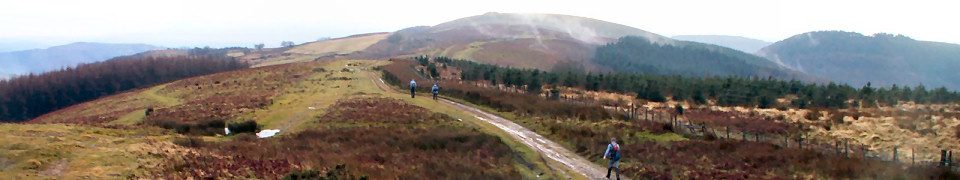
Black Mountain Side, 19 miles, Saturday 27th February 2016, Route: (view, download), Photographs
Meet/Start time : 08:30. At: Byefield Lane (free) c.p. Tudor Street, Abergavenny, SO296141
Description: We visit Mynydd Pen-y-fal, descend to Llanbedr and explore Crug Mawr. We will be become spiritual at Partrishow before returning to the start via Deri.
Notes: Apologies to Jason for leading a walk when he has a weekend planned. I can't make the weekend away due to family commitments and am aware that others in the group want to have a local walk on Saturday 27th.
Grid reference(s):Meet: SO 296 141, Start: SO 296 141
Map(s):Landranger: 161
Leader: David Morgan
Rhayader Winter Round About (continued), 15+ miles, Sunday 28th February 2016,
Location, Details
Rhayader Winter Round About (continued), 15+ miles, Sunday 28th February 2016,
Location
Meet/Start time : Bothy at the head of the Afon Towy
Description: (Continued from Saturday 27 Feb). From the Bothy to the Claerwen Dam via Afon Arban and follow (initially) the Afon Claerwen, onwards towards Cnwch then a large loop around back to the cars.
Description: There are many small Satellite hills around Brecon that get missed out because of the Honey Pots, this walk intends to explore those small hills.
Notes: Contact Jason for the start grid reference.
Grid reference(s):Meet: SO 024 248, Start: SO 024 248
Meet/Start time : 09:00. At: Free car park east of Cwmbran railway station (not the railway car park), ST300958
Description: The southern loop of the Torfaen Trail. (No connection with the Taith Torfaen).
Grid reference(s):Meet: ST 300 958, Start: ST 300 958, Finish: ST 299 958
Map(s):Explorer: 152. Landranger: 171
Leader: Claire & Grae
Forest of Dean by Royal Appointment, 15 miles, Wednesday 16th March 2016,
Location, Photographs, Details
Forest of Dean by Royal Appointment, 15 miles, Wednesday 16th March 2016,
Location, Photographs
Meet/Start time : 09:00. At: Cyril Hart Arboretum car park, NE of Speech House, SO623123
Description: A walk through the Forest, taking in Ruspidge, Blakeneyhill Wood, New Fancy View, Parkend, Nagshead Plantation, Cannop Ponds, Cyril Hart Arboretum.
Grid reference(s):Meet: SO 623 123, Start: SO 623 123
Woodland, Wireworks and Worship, 23 miles, Saturday 2nd April 2016, Route: (view, download), Photographs
Meet/Start time : 08:00. At: Fedw Wood car parking area, ST506984
Description: A walk through the wooded and pastoral landscape of Monmouthshire taking in some of its industrial and ecclesiastical history. Chepstow Park, Fedw and Ravensnest Woods, as well as the Golden and Angidy Valleys, passing churches at Penterry and Kilgwrrwg
Grid reference(s):Meet: ST 506 984, Start: ST 506 984
Over the hills and far away, 43 miles, Saturday 30th April 2016, Route: (view, download), Photographs
Meet/Start time : 07:00. At: Barry Sidings Countryside Park, ST054908
Description: Preparation for 'The Big One' in a month's time. A circuit of our Rhondda hills with 8500 feet ascent. Self supported with an opportunity to replenish at 19 miles. Brisk pace. Exposed route so please ensure rucksack is appropriately packed. Opportunity for guests to leave walk after either 12.5 and walk 2.5 miles downhill to Ton Pentre Train Station or 24 miles and walk downhill 1 mile to Treherbert Train Station and catch trains back to Trehafod. Pub Stop with 5.5 miles to go!
Grid reference(s):Meet: ST 054 908, Start: ST 054 908
Meet/Start time : 08:30. At: Far end of car park (pay & display), off Wilton Road, SO593239
Description: Start point is just off Wilton Road after crossing Wye Bridge. The walk is very varied with some lovely locations, including May Hill. Plenty of hills to keep you happy!
Grid reference(s):Meet: SO 593 239, Start: SO 593 239
Map(s):Explorer: OL14
Leader: Rob Wilkinson
Scenes of Cwmcarn, 13 miles, Wednesday 11th May 2016, Route: (view, download), Details
Scenes of Cwmcarn, 13 miles, Wednesday 11th May 2016, Route: (view, download)
Meet/Start time : 09:00. At: Cwmcarn Rugby & Bowls Club car park , ST215941
Description: Cwmcarn, Wattsville, Ynysddu, Wylie, taking in sections of Ebbw Valley Walk, Raven Walk, Twmbarlwm Trek, Where Ravens Dare, Caerphilly Summits
Grid reference(s):Meet: ST 215 941, Start: ST 215 941
Map(s):Explorer: 152
Leader: Hugh Woodford
The Good, The Bad and The Ugly, 16 miles, Saturday 21st May 2016, Route: (view, download), Details
The Good, The Bad and The Ugly, 16 miles, Saturday 21st May 2016, Route: (view, download)
Meet/Start time : 09:00. At: Pen y Fan Pond car park (charges apply), SO199006
Description: High level walk heading north to Ebbw Vale and Y Domen Fawr, taking in a section of Ebbw Valley Walk and some of the finer parts of Ebbw Vale.
Grid reference(s):Meet: SO 199 006, Start: SO 199 006
Meet/Start time : 09:00. At: Village Hall Car Park at Dingestow , SO458103
Description: From Dingestow, climb towards Cwmcarvan church and on to historic Trellech and hilly Llanishen before returning through gentle Monmouthshire countryside and a possible stop at The Somerset Arms, close to our car park.
Grid reference(s):Meet: SO 458 103, Start: SO 458 103
Map(s):Explorer: OL 14
Leader: Rob Wilkinson
Western Valleys and Ridges, 17 miles, Wednesday 8th June 2016,
Location, Details
Western Valleys and Ridges, 17 miles, Wednesday 8th June 2016,
Location
Meet/Start time : 08:30. At: Waste ground off A4046 nr Aberbeeg Roundabout , SO206020
Description: A much repeated old favourite, taking in Cwm, Cwm Merddog nature reserve, Blaina, Cwmtillery, Llanhilleth, Aberbeeg
Grid reference(s):Meet: SO 206 020, Start: SO 206 020
Meet/Start time : 10:00. At: Log Cabin, Woodlands Field Recreation Park Community Centre, Folly View, Penygarn, Pontypool, NP4 8BU , SO287014
Description: The Taith Torfaen Marshals' Walk, for those who helped run the event on the 9/10th April. This is a 24 hour event. Rod Hollands is co-ordinating the mobile checkpoints to provide support to the entrants. Badge & certificate to all who complete the challenge. It is hoped that with sufficient support, walkers can walk the event at their own pace
Notes: If you didn't help marshal main event please don't ask to enter. This is for people who gave up their weekend to put the Taith Torfaen on for our guests. Any person who can offer support to Rod by running a checkpoint please make contact with him
Grid reference(s):Meet: SO 287 014, Start: SO 287 014
Map(s):Explorer: OL 13, 152, 166. Landranger: 171, 161
Meet/Start time : 08:30. At: Chepstow: Park in road by Home Base or Caerwent Lane, NP16 5TY , ST538917
Description: Walk over Severn Bridge on Right Hand Side to Aust. Follow Severn way, Jubilee Way to Wale Warth, Cowhill, Old Down, Catherine Hill, Northwick, Old Passage and return to Aust and Severn Bridge on opposite side
Grid reference(s):Meet: ST 538 917, Start: ST 538 917
Meet/Start time : 07:00. At: Pontypool Leisure Centre Car Park NP4 8AT , SO285006
Description: Reverse route of last year's 40 miler with extra loop around Llandegfedd. So, New Inn, Monkswood, Goytre, Coed Bwynedd, Clytha, Usk Valley Way, Llanellen, Llanfoist, The Incline, Keeper's Pond and then choice of routes
Grid reference(s):Meet: SO 285 006, Start: SO 285 006
Rhymney Valley Roundabout, 26 miles, Saturday 20th August 2016, Route: (view, download), Photographs
Meet/Start time : 08:00. At: Lisvane and Thornhill Station car park (free), ST178835
Description: A repeat of one of the South Wales group classics. Following the ridgeway to Caerphilly Common and Mynydd Meio, then Mynydd Eglwysilan. Onto Mynydd Machen via Ystrad Mynach and return through Rudry.
Notes: Undulating route with approx 5000ft ascent.
Grid reference(s):Meet: ST 178 835, Start: ST 178 835
Beacons Way Part 2, 26.5 miles, Saturday 27th August 2016, Route: (view, download), Photographs
Meet/Start time : 08:00. At: Pont ar Daf Car Park, A470, SN988198
Description: Continuing the Beacons Way from Crickhowell to Storey Arms; on the way visit the Llangattock Escarpment and the summits of the Central Beacons Massif
Notes: A minibus to take walkers from Pont ar Daf to Crickhowell. Please book yourself on the minibus with Jason
Grid reference(s):Meet: SN 988 198, Start: SO 218 186, Finish: SN 988 198
Ludlow Weekend - Day 1, 21-23 miles, Saturday 17th September 2016, Route: (view, download), Photographs
Meet/Start time : 08:45. At: Outside Ludlow Castle, SO508746
Description: S Wales group weekend away
Notes: South west to Croft Ambrey and Aymestrey, then on to Wigmore, Burrington, Downton Castle and Bromfield. Some flat bits !
Grid reference(s):Meet: SO 508 746, Start: SO 508 746
Map(s):Explorer: 203
Leader: Rob Wilkinson
Ludlow Weekend - Day 2 The blue remembered hills, 17 miles, Sunday 18th September 2016, Route: (view, download), Photographs, Details
Ludlow Weekend - Day 2 The blue remembered hills, 17 miles, Sunday 18th September 2016, Route: (view, download), Photographs
Meet/Start time : 00:09. At: Clee St Margaret Village Hall, SO565843
Description: Titterstone Clee, Brown Clee, Abdon Burf,and including Nordy Bank, The Lurkeys, The Thrift, Pel Beggar and other delights. Spectacular views are expected. Tea and biscuits in village hall to finish.
Notes: The village hall is signposted in the lanes around the village.
Grid reference(s):Meet: SO 565 843, Start: SO 565 843
Map(s):Landranger: 137
Leader: John Roberts
Black Mountains - The Pilgrimage to Partishow, 30 miles, Saturday 24th September 2016, Route: (view, download), Photographs, Details
Black Mountains - The Pilgrimage to Partishow, 30 miles, Saturday 24th September 2016, Route: (view, download), Photographs
Meet/Start time : 08:00. At: Park in the Bailey car park in Abergavenny, SO296139
Description: Walking from the car park out to Crug Mawr and Partishow Church
Grid reference(s):Meet: SO 296 139, Start: SO 296 139
The Monmouthshire Way Part 1, 17 miles, Saturday 12th November 2016, Route: (view, download), Photographs
Meet/Start time : 08:30. At: Cattle Market Car Park, Monmouth. Car Park Fees Apply, SO505124
Description: The first of several walks of the Monmouthshire Way, a walk designed by David Morgan that explores the ancient county of Monmouthshire.
Notes: A minibus will take walkers from Monmouth to Chepstow Leisure Centre and we will then walk back to our cars. Please book your space with David ASAP. Please bring a torch.
Grid reference(s):Meet: SO 505 124, Start: ST 529 943, Finish: SO 505 124