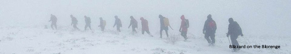
Cancelled: Major Splatt Pudding's Secret Route to Freedom, 25 miles, Wednesday 1st January 2025, Location, Details
Cancelled: Major Splatt Pudding's Secret Route to Freedom, 25 miles, Wednesday 1st January 2025, Location
- Changes: Cancelled due to yellow weather warning. Significant landslip and rockfall in Cwmtillery has reduced the route to 25 miles from 28 miles.
- Meet/Start time : 09:00. At: The Rifleman's Car Park, Blaenavon, Opposite the Rifleman's Pub (Post Code - NP4 9QS) , SO25180941
- Description: A strange but interesting circuitous route around Blaenavon, Varteg, Cwmtillery Lakes and Llanelli Hill
- Notes: Bring a headtorch and a hot drink
- Grid reference(s): Meet: SO 2518 0941, Start: SO 2518 0941
- Map(s): Explorer: OL13, 152
- Walk Grade: **** (Strenuous). (What's this?)
- Ascent (feet): 6200
- Leader: Jason Winney
Cancelled: Back in time for Tea, 16 miles, Saturday 4th January 2025, Location, Details
Cancelled: Back in time for Tea, 16 miles, Saturday 4th January 2025, Location
- Changes: Amber weather warning for snow / ice / freezing rain.
- Meet/Start time : 09:00. At: Car Park at north end of Talybont Reservoir. Plan getting there carefully! The Vaynor road between Trefechan and Ponsticill is closed, so you need to get there via Pant. Check A465 closures too , SO054144
- Description: A perambulation across Merthyr Common, Cefn yr Ystrad and the Dyffryn Crawnon valley. Lots of open moorland, generally on reasonable (ish) tracks.
- Notes: Exposed. You must be well equipped for winter hillwalking - three stars reflect potential difficulty in poor conditions. Whilst we'll probably be back in time for tea, please bring a torch. If conditions are very poor, I'll adapt the walk. Mini Paw of Approval awarded.
- Grid reference(s): Meet: SO 054 144, Start: SO 054 144
- Map(s): Explorer: OL13
- Walk Grade: *** (Hard). (What's this?)
- Ascent (feet): 2600
- Leader: Mike Batt
Simon and the Templars, 16 miles, Saturday 11th January 2025, Route: (view, download), Photographs, Details
Simon and the Templars, 16 miles, Saturday 11th January 2025, Route: (view, download), Photographs
- Meet/Start time : 09:00. At: Parking area in front of Skenfrith Castle (SO457203). There is additional parking, if required, in layby appox 300m away (over bridge) at SO459203, SO457203
- Description: A circumnavigation of Garway Hill, enjoying its panoramic views across England and Wales. We will call at St Michael's Church, one of the best preserved Knights Templar sites in Britain. Much of the walk is rural, so quite a few stiles and not recommended for dogs.
- Grid reference(s): Meet: SO 457 203, Start: SO 457 203
- Map(s): Explorer: 189. Landranger: 161
- Walk Grade: ** (Moderate). (What's this?)
- Ascent (feet): 2600
- Leader: Simon Pickering
North to Rhymney, 35 miles, Saturday 18th January 2025, Route: (view, download), Details
North to Rhymney, 35 miles, Saturday 18th January 2025, Route: (view, download)
- Meet/Start time : 07:30. At: Rhymney Train Station Park & Ride, SO11170752
- Description: Walking from Lisvane to Rhymney on various paths, we'll end up in darkness so bring a torch with you. We'll be catching the train from Rhymney down to Lisvane and walking back to Rhymney. The train is at 07:45 and gets into Lisvane at 08:23 - The cost is £5:50 (Single). Note : If your going to be leaving the walk at Ystrad Mynach then you will need to purchase a return ticket.
- Notes: You can drop out at Ystrad Mynach and catch the train to Rhymney which will make the walk 18.5 miles or so... Trains to Rhymney are usually hourly.
- Grid reference(s): Meet: SO 1117 0752, Start: ST 1783 8348, Finish: SO 1117 0752
- Map(s): Explorer: 151,166,OL13
- Walk Grade: *** (Hard). (What's this?)
- Ascent (feet): 5500
- Leader: Jason Winney
North to Ystrad Mynach, 18.1 miles, Saturday 18th January 2025, Route: (view, download), Details
North to Ystrad Mynach, 18.1 miles, Saturday 18th January 2025, Route: (view, download)
- Meet/Start time : 07:30. At: Meet at Ystrad Mynach Station Car Park to catch a train to Lisvane station, ST14159428
- Description: The first half of the "North to Rhymney" held on the same day. Walking with the group on the longer route but finishing at Ystrad Mynach instead of Rhymney,
- Grid reference(s): Meet: ST 1415 9428, Start: ST 1788 8347, Finish: ST 1415 9428
- Map(s): Explorer: 151, 166
- Walk Grade: ** (Moderate). (What's this?)
- Ascent (feet): 3590
- Leader: Jason Winney
Macnamara's road and the cefn-ffordd, 17 miles, Saturday 25th January 2025, Route: (view, download), Photographs, Details
Macnamara's road and the cefn-ffordd, 17 miles, Saturday 25th January 2025, Route: (view, download), Photographs
- Meet/Start time : 08:30. At: Crickhowell Community Sports Centre, New Road, Crickhowell NP8 1AW, SO216185
- Description: Heading out on an old road through a quiet valley and returning on an ancient track along the top of one of the neverending ridges of the Black Mountains... Plenty to see - fantastic views (weather permitting), ruins, boundary stones and a hillfort...
- Grid reference(s): Meet: SO 216 185, Start: SO 216 185
- Map(s): Explorer: OL13. Landranger: 161
- Walk Grade: ** (Moderate). (What's this?)
- Ascent (feet): 3400
- Leader: Henny Clare
Major Splatt Pudding's Secret Route to Freedom, 25 miles, Saturday 1st February 2025, Route: (view, download), Photographs, Details
Major Splatt Pudding's Secret Route to Freedom, 25 miles, Saturday 1st February 2025, Route: (view, download), Photographs
- Meet/Start time : 09:00. At: The Rifleman's Car Park, Blaenavon, Opposite the Rifleman's Pub (Post Code - NP4 9QS) , SO25180941
- Description: A strange but interesting circuitous route around Blaenavon, Varteg, Cwmtillery Lakes and Llanelli Hill
- Notes: Bring a headtorch and a hot drink
- Grid reference(s): Meet: SO 2518 0941, Start: SO 2518 0941
- Map(s): Explorer: OL13, 152
- Walk Grade: **** (Strenuous). (What's this?)
- Ascent (feet): 6200
- Leader: Jason Winney
Circles of Confusion 2 (91), 19 miles, Saturday 8th February 2025, Route: (view, download), Photographs, Details
Circles of Confusion 2 (91), 19 miles, Saturday 8th February 2025, Route: (view, download), Photographs
- Meet/Start time : 08:30. At: Peckett Stone Car Park (free), SO504074
- Description: Following the success of Circles of Confusion 1, another opportunity to become disoriented, achieve giddiness and walk on good tracks in the middle of winter.
- Notes: Confusion isn't guaranteed and all participants will receive a prize for attending and entering the matrix. Some trees may be recognised, more often than not you won't have a clue. 9 stiles in total and some field walking with cracking views (weather dependent!)
- Grid reference(s): Meet: SO 504 074, Start: SO 504 074
- Map(s): Explorer: 14. Landranger: 162
- Walk Grade: ** (Moderate). (What's this?)
- Ascent (feet): 2137
- Leader: David & Gill Morgan
To the Source, 21 miles, Saturday 15th February 2025, Route: (view, download), Photographs, Details
To the Source, 21 miles, Saturday 15th February 2025, Route: (view, download), Photographs
- Meet/Start time : 08:30. At: Parking for about 10 cars in layby by radio transmitter on southbound side of A470. Just south of turn off to Garwnant Visitor Centre. Please carshare if you can., SO00651312
- Description: A loop up to Corn Du and then straight down into the Taff Fechan valley, crossing back to car via Garn Du. Mixture of trails and off piste walking.
- Notes: Be equipped for winter mountain walking, a steep descent (sticks very helpful) and boggy moments. Bring a torch. Mini paw of approval granted (on a nice day!).
- Grid reference(s): Meet: SO 0065 1312, Start: SO 0065 1312
- Map(s): Explorer: OL12
- Walk Grade: **** (Strenuous). (What's this?)
- Ascent (feet): 3660
- Leader: Mike Batt
Tour de Dursley, 17 miles, Saturday 22nd February 2025, Route: (view, download), Photographs, Details
Tour de Dursley, 17 miles, Saturday 22nd February 2025, Route: (view, download), Photographs
- Meet/Start time : 09:00. At: Old Spot Inn Hill Rd, Dursley GL11 4JQ (cp opposite, or adjacent streets) , ST753980
- Description: Touring villages, vales and viewpoints around Dursley. Vistas of Wales a possibility. Grid reference ST 753 980
- Grid reference(s): Meet: ST 753 980, Start: ST 753 980
- Map(s): Explorer: 167 & 168
- Walk Grade: ** (Moderate). (What's this?)
- Ascent (feet): 2000
- Leader: John Roberts
March on the Ridgeway, 25 miles, Saturday 1st March 2025, Route: (view, download), Photographs, Details
March on the Ridgeway, 25 miles, Saturday 1st March 2025, Route: (view, download), Photographs
- Meet/Start time : 08:30. At: Machen Village Hall carpark, ST2095989095
- Description: A surprisingly hilly walk taking in Mynydd Machen and the Cardiff Ridgeway out to Craig yr Allt and Fforest Fawr. Investigating the early signs of spring :)
- Notes: Good paths. QC - Mini Paw of Approval.
- Grid reference(s): Meet: ST 20959 89095, Start: ST 20959 89095
- Map(s): Explorer: 151; 152; 166
- Walk Grade: *** (Hard). (What's this?)
- Ascent (feet): 4600
- Leader: Mike Batt
50, 25 miles, Saturday 8th March 2025, Route: (view, download), Photographs, Details
50, 25 miles, Saturday 8th March 2025, Route: (view, download), Photographs
- Meet/Start time : 08:00. At: Sports Centre car park off New Road, SO216185
- Description: 50 years ago to the day I completed the my first challenge walk. It was the Abergavenny Three Peaks which in 1975 started and finished at Crickhowell Youth Hostel. This is a repeat of that route as far as practical.
- Notes: Public toilets at 10.5 miles
- Grid reference(s): Meet: SO 216 185, Start: SO 216 185
- Map(s): Explorer: OL13. Landranger: 161
- Walk Grade: *** (Hard). (What's this?)
- Ascent (feet): 5300
- Leader: Andrew Clabon
Rhondda Rollercoaster Marshals' Walk (16 miles) , 16 miles, Saturday 15th March 2025, Route: (view, download), Photographs, Details
Rhondda Rollercoaster Marshals' Walk (16 miles) , 16 miles, Saturday 15th March 2025, Route: (view, download), Photographs
- Meet/Start time : 09:00. At: Car Park at end of Lewis Street., ST045909
- Description: The 16 mile version of the Rhondda Rollercoaster Marshals'Walk. Led as a social walk by the walk leader
- Grid reference(s): Meet: ST 045 909, Start: ST 045 909
- Map(s): Explorer: 166. Landranger: 170
- Walk Grade: *** (Hard). (What's this?)
- Leader: N/A
Up to his old tricks again !!, 27 miles, Saturday 22nd March 2025, Route: (view, download), Photographs, Details
Up to his old tricks again !!, 27 miles, Saturday 22nd March 2025, Route: (view, download), Photographs
- Meet/Start time : 08:00. At: Meet at Rhymney Train Station - catching the 08:10am train to Lisvane/Thornhill (£4.40 single) Getting to Lisvane at 08:55am , SO11170752
- Description: Walking back to Rhymney using this time lesser used routes - we at times touch on some of the earlier route we walked back in the beginning of Feb. You can also leave the walk after 16.5 miles at Ystrad Mynach if you fancy a shorter day.
- Grid reference(s): Meet: SO 1117 0752, Start: ST 1786 8344, Finish: SO 1117 0752
- Map(s): Explorer: 151,166,OL13
- Walk Grade: *** (Hard). (What's this?)
- Ascent (feet): 4800
- Leader: Jason Winney
Mid Spring Wild Camp Walk, 10 miles, Saturday 29th March 2025, Route: (view, download), Photographs, Details
Mid Spring Wild Camp Walk, 10 miles, Saturday 29th March 2025, Route: (view, download), Photographs
- Changes: Breakfast at the Café starts at 10:30am if you fancy a bacon roll
- Meet/Start time : 11:00. At: Corris Visitors Center (the rough carpark at the back end of the mail car park, SH75180778
- Description: Walking from Corris to Abergynolwyn via the Tarren's and localised hills of Abergynolwyn
- Grid reference(s): Meet: SH 7518 0778, Start: SH 7518 0778, Finish: SH 6774 0696
- Map(s): Explorer: OL23
- Walk Grade: *** (Hard). (What's this?)
- Ascent (feet): 3000
- Leader: Jason Winney
The Dragon and the Whale, 19 miles, Saturday 29th March 2025, Route: (view, download), Photographs, Details
The Dragon and the Whale, 19 miles, Saturday 29th March 2025, Route: (view, download), Photographs
- Meet/Start time : 09:00. At: The Dinas Castle Inn (formerly the Dragon’s Back Inn) walkers carpark, Pengenffordd, LD3 0EP. £5 for the day - paid via the honesty box. Grid ref: SO174296, SO174296
- Description: Circular route heading out up the Dragon’s back and returning over Waun Fach (with a ridge, a down and a big up in between). Quite a lot of ascent for the distance and great views if the weather allows. The walk includes two major ups, both are quite big pulls as the total ascent for the walk is 4000ft
- Notes: Car park a good size, but please car share if you can.
- Grid reference(s): Meet: SO 174 296, Start: SO 174 296
- Map(s): Explorer: OL13. Landranger: 161
- Walk Grade: *** (Hard). (What's this?)
- Ascent (feet): 4000
- Leader: Henny Clare
Mid Spring Wild Camp Walk, 16 miles, Sunday 30th March 2025, Location, Details
Mid Spring Wild Camp Walk, 16 miles, Sunday 30th March 2025, Location
- Meet/Start time : 09:00. At: Abergynolwyn , SH67740696
- Description: Walking towards Dolgellau with great views over the estuary
- Grid reference(s): Meet: SH 6774 0696, Start: SH 6774 0696, Finish: SH 6620 1626
- Map(s): Explorer: OL23
- Walk Grade: *** (Hard). (What's this?)
- Ascent (feet): 4500
- Leader: Jason Winney
Mid Spring Wild Camp Walk, 16 miles, Monday 31st March 2025, Location, Details
Mid Spring Wild Camp Walk, 16 miles, Monday 31st March 2025, Location
- Meet/Start time : 09:00. At: From Dolgellau , SH66201626
- Description: From Dolgellau to Corris
- Grid reference(s): Meet: SH 6620 1626, Start: SH 6620 1626, Finish: SH 7518 0778
- Map(s): Explorer: OL23
- Walk Grade: *** (Hard). (What's this?)
- Ascent (feet): 3200
- Leader: Jason Winney
2025 Spring Loosener / Nine Hills of Abergavenny.., 38 miles, Saturday 12th April 2025, Route: (view, download), Photographs, Details
2025 Spring Loosener / Nine Hills of Abergavenny.., 38 miles, Saturday 12th April 2025, Route: (view, download), Photographs
- Meet/Start time : 08:30. At: Byefield Road Carpark, Abergavenny, SO29681404
- Description: A new route from Abergavenny, taking in 9 peaks - including some you might not expect... a chance for old and new group members to do a SWLDWA Spring Loosener, which now returns with possibly the toughest yet. Dare you take it on?
- Notes: Self-supported. No food resupply opportunities,but plenty of streams. We'll do this at a sociable and accommodating pace. Winter mountain kit and torches needed. Anyone dropping out needs to make their own way back to Abergavenny - can leave at 12.5 miles [Grid Ref: SO2882 2280] for a 20 mile ish walk.
- Grid reference(s): Meet: SO 2968 1404, Start: SO 2968 1404
- Map(s): Explorer: OL13
- Walk Grade: ***** (Very Strenuous). (What's this?)
- Ascent (feet): 9200
- Leader: Mike Batt
Marshal walk - 26ml Rhondda Rollercoaster , 26 miles, Saturday 19th April 2025, Route: (view, download), Photographs, Details
Marshal walk - 26ml Rhondda Rollercoaster , 26 miles, Saturday 19th April 2025, Route: (view, download), Photographs
- Meet/Start time : 08:00. At: Trehafod village hall car park, ST045909
- Description: The 26ml Rhondda Rollercoaster walk. This is for Marshals on the main event only and will be led as a social walk.
- Notes: You know the drill! Like the challenge walk, but self supporting. Chance to refuel at around 16ml. Only for marshals on the main event
- Grid reference(s): Meet: ST 045 909, Start: ST 045 909
- Map(s): Explorer: 166. Landranger: 170
- Walk Grade: **** (Strenuous). (What's this?)
- Ascent (feet): 5000
- Leader: Jamie Lewis
Extra Somewhat Moorish, 22 miles, Saturday 3rd May 2025, Route: (view, download), Photographs, Details
Extra Somewhat Moorish, 22 miles, Saturday 3rd May 2025, Route: (view, download), Photographs
- Meet/Start time : 09:00. At: Park at Crickhowell Sports Centre, New Road, Crickhowell., SO219188
- Description: Over to the Lonely Shepherd and then a meandering walk across the moors as far as the Chartist's Cave, linking some points of interest, legend and history as we wander across an empty land.
- Notes: Often faint or non-existent paths, but generally ok walking apart from one impressive bit of bog to splodge through and some tussocky goodness. Maybe not for those who don't like off-path walking, but it isn't that bad. Exposed most of the day.
- Grid reference(s): Meet: SO 219 188, Start: SO 219 188
- Map(s): Explorer: OL13
- Walk Grade: *** (Hard). (What's this?)
- Ascent (feet): 2400
- Leader: Mike Batt
The Tintern Variations (Pt 3: The Northern Movement), 22 miles, Saturday 17th May 2025, Route: (view, download), Photographs, Details
The Tintern Variations (Pt 3: The Northern Movement), 22 miles, Saturday 17th May 2025, Route: (view, download), Photographs
- Meet/Start time : 08:30. At: Lower Wireworks car park, Forge Road, Tintern, SO527001
- Description: The (very) late arriving third instalment in a series of walks revealing where the walk leader wandered during lockdown. From Tintern we head North (obviously!) through Cleddon and Beacon Hall before descending to Mitchel Troy before returning home via the rolling Monmouthshire countryside around Cwmcarvan and Llanishen.
- Grid reference(s): Meet: SO 527 001, Start: SO 527 001
- Map(s): Explorer: OL14. Landranger: 161, 162, 171
- Walk Grade: *** (Hard). (What's this?)
- Ascent (feet): 4000
- Leader: Simon Pickering
Back in time for Tea, 16 miles, Saturday 7th June 2025, Route: (view, download), Photographs, Details
Back in time for Tea, 16 miles, Saturday 7th June 2025, Route: (view, download), Photographs
- Meet/Start time : 09:00. At: Car park at north end of Ponsticill reservoir., SO054144
- Description: Re-scheduled walk from 4th Jan. A perambulation across Merthyr Common, Cefn yr Ystrad and across the Dyffryn Crawnon valley. Open moorland, reasonable (ish) tracks.
- Notes: A gentle June amble and a nice wind down after all our challenge walks. Although be mindful of exposure if it's a poor weather forecast. Mini Paw of Approval awarded.
- Grid reference(s): Meet: SO 054 144, Start: SO 054 144
- Map(s): Explorer: OL13
- Walk Grade: ** (Moderate). (What's this?)
- Ascent (feet): 2600
- Leader: Mike Batt
Both Sides Now, 24 miles, Saturday 21st June 2025, Route: (view, download), Photographs, Details
Both Sides Now, 24 miles, Saturday 21st June 2025, Route: (view, download), Photographs
- Meet/Start time : 08:30. At: Craig y Ddinas CP, Pontneddfechan, SN911079
- Description: Visiting areas south and north of the Heads of the Valleys road. Looking at the historical use of the landscape and it's transformation through leisure activities, land reclamation and a growing awareness of the importance of biodiversity in these areas.
- Notes: Various types of terrain with a few rough and boggy parts. As usual, there are a few seldom used paths to navigate but there's a nice watery flourish to finish. A handy store at about 11 miles if needed.
- Grid reference(s): Meet: SN 911 079, Start: SN 911 079
- Map(s): Explorer: OL12 OL166
- Walk Grade: *** (Hard). (What's this?)
- Ascent (feet): 3000
- Leader: Tony Alcock
Ice-Creams@Southgate, 20 miles, Saturday 28th June 2025, Location, Details
Ice-Creams@Southgate, 20 miles, Saturday 28th June 2025, Location
- Meet/Start time : 09:00. At: National Trust Carpark at Southgate opposite the shop, SS55398739
- Description: Starting from Southgate, we head across Pennard Burrows, following the scenic route through Ilston Cwm to reach the historic Ilston Church. From there, we continue through Parc-le-Breos and ascend Cefn Bryn, enjoying panoramic views across the Gower. Our path then leads through Penrice Woods, before dropping down to walk along the beach at Oxwich Bay. We finish by climbing back up to Pennard Castle, perched on the burrows, before returning to Southgate.
- Notes: The NT carpark is chargeable for those who are not not NT members. If we make it back in time, the shop is usually open for Ice creams :-)
- Grid reference(s): Meet: SS 5539 8739, Start: SS 5539 8739
- Map(s): Explorer: 164
- Walk Grade: ** (Moderate). (What's this?)
- Ascent (feet): 2500
- Leader: Jason Winney / Laura Turner