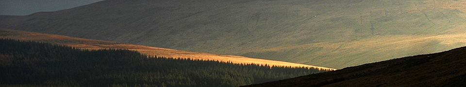
South Wales group walks in 2010 - select Leekman marker for details
B and B in the BB, 14 miles, Saturday 2nd January 2010, Route: (view, download), Photographs
- Changes: The planned start point was from the Cwm Gwdi car park. (From A470 roundabout south of Brecon; B4601 towards town centre for 0.25 miles; just before Drovers Arms turn right into Ffrwdgrech Road; ahead for 0.7 miles to tri-junction and fork left; ahead 1.5 miles to where road turns sharp right; here go ahead on lane for 0.25 miles to Cwm Gwdi car park).
- Meet/Start time : 08:30. At: Actually started from the Pont ar Daf car park on the A470 as the original start point was closed by snow., SN987200
- Description: Brisk and Bracing circuit of the central Brecon Beacons to get rid of that post-Christmas sluggish feeling.
- Notes: Fine and bright with snow cover. Some cloud on tops in the morning. Anticlockwise walk.
- Grid reference(s): Meet: SN 987 200, Start: SN 987 200
- Map(s): Explorer: OL12
- Leader: Dave Williams
From Winter to Summer, 17.5 miles, Sunday 17th January 2010, Route: (view, download), Photographs
- Meet/Start time : 09:00. At: Dorallt Inn, Henllys, Cwmbran, ST265939
- Notes: WEATHER: Fine and bright with some snow cover. Anticlockwise walk
- Grid reference(s): Meet: ST 265 939, Start: ST 265 939
- Map(s): Explorer: 152
- Leader: Rob Wilkinson
Strawberries In Winter?, 20.5 miles, Sunday 31st January 2010, Route: (view, download), Photographs
- Changes: Access to the planned start point near Stanton was restricted by ice/snow.
- Meet/Start time : 08:30. At: Llanfihangel Crucorney, SO328208
- Description: Around the Llanthony Valley in the Black Mountains.
- Notes: WEATHER: Overcast with some snow showers. Anti-clockwise walk.
- Grid reference(s): Meet: SO 328 208, Start: SO 328 208
- Map(s): Explorer: OL13. Landranger: 161
- Leader: Hugh Woodford
East Glamorgan Heritage Coast, 15.5 miles, Saturday 6th February 2010, Route: (view, download), Photographs
- Meet/Start time : 09:00. At: Barry Island railway station (ample car parking on road directly alongside station)., ST114669
- Description: A scenic and moderate linear coast path walk including Jackson and Whitmore Bays along to Summerhouse Point. Return by train from Llantwit Major railway station.
- Notes: Fine bright day. A linear walk to Llantwit Major
- Grid reference(s): Meet: ST 114 669, Start: ST 114 669, Finish: SS 970 689
- Map(s): Explorer: 151
- Leader: John Cunnane
Star Trek 2 - The Voyage Continues, 20 miles, Sunday 21st February 2010, Route: (view, download), Photographs
- Meet/Start time : 08:30. At: Car park under railway viaduct arches in Mill Street, Pontypridd. , ST069903
- Notes: Wet start but soon fine with snow underfoot. A clockwise walk.
- Grid reference(s): Meet: ST 069 903, Start: ST 069 903
- Map(s): Explorer: 166
- Leader: Gwyn Matthews
Sor brook - sore feet, 21.5 miles, Saturday 6th March 2010, Route: (view, download), Photographs
- Changes: The planned start was at the car park above the Llandegfedd Reservoir to the west of Coed-y-Paen, but changed due to early closure of car park.
- Meet/Start time : 08:20. At: Started at a car park on the edge of Usk., SO373012
- Description: Approximately 20 miles. 8:00am start at car park above the Llandegfedd Reservoir to the west of Coed-y-Paen.
Map: Landranger 171 or Explorer 152. GR: ST 328985.
Leader: Gerry Jackson. Tel: 01633 482175. - Notes: Fine start but cloud developing. A clockwise walk.
- Grid reference(s): Meet: SO 373 012, Start: SO 373 012
- Map(s): Explorer: 152. Landranger: 171
- Leader: Gerry Jackson
Mothers\' Day Special, 17 miles, Sunday 14th March 2010, Route: (view, download)
- Meet/Start time : 09:00. At: 14 Locks Visitor Centre (near M4 junction 27), ST279886
- Description: Includes Machen Mountain, Ruperra Castle, Park Wood and Rhiwderin.
- Notes: Dry, but cool day.
- Grid reference(s): Meet: ST 279 86 , Start: ST 279 86
- Map(s): Explorer: 152. Landranger: 171
- Leader: Claire Murray
Spring in the Vale, 22.5 miles, Saturday 20th March 2010, Route: (view, download), Photographs
- Meet/Start time : 08:00. At: Llantwit Major railway station for train to Bridgend Railway Station (contact leader beforehand to confirm train time). , SS970689
- Description: Linear walk of western inland sections of VMHT.
- Notes: Very muddy! Wet start but it improved after the lunch stop.
- Grid reference(s): Meet: SS 970 689, Start: SS 907 798, Finish: SS 970 689
- Map(s): Explorer: 151
- Leader: Alun Jones
Dave\'s Rhondda Romp, 26.5 miles, Saturday 17th April 2010, Route: (view, download), Photographs
- Meet/Start time : 08:30. At: Car park by St Peter's Church, Pentre Street, Pentre, Rhondda (M4 to J34; A4119 north via Talbot Green and Tonypandy; to Pentre)., SS969961
- Notes: Clockwise walk. Cloudless warm day.
- Grid reference(s): Meet: SS 969 961, Start: SS 969 961
- Map(s): Explorer: 166
- Leader: Dave Williams
Newton to Barry - The Heritage Coast, 27 miles, Saturday 8th May 2010, Route: (view, download), Photographs
- Meet/Start time : 08:00. At: St. Johns Church, Newton, ST114667
- Description: Meet at Barry Island railway station - large car park on left.(Turn under bridge at junction just before station. Possible charge). Contact John to book minibus to start in Porthcawl. A splendid linear walk along the entire Glamorgan Heritage Coast.
- Notes: Cloudy with light rain at times. Linear walk.
- Grid reference(s): Meet: ST 114 667, Start: SS 836 775, Finish: ST 114 667
- Map(s): Explorer: 151
- Leader: John Cunnane
Two Castles a Mill and a Wall, 18.5 miles, Sunday 16th May 2010, Route: (view, download), Photographs
- Meet/Start time : 09:00. At: Magor, ST425870
- Description: From car park just off Sycamore terrace about 100 yards from St. Mary's Church, Magor (Please do not use car park next to church). A walk around the St. Brides valley and Gwent levels.
- Notes: Clockwise walk. Average moving speed was 3.2 mph. Cloudy with a little light rain in the morning. A few heavy showers in the afternoon.
- Grid reference(s): Meet: ST 425 870, Start: ST 425 870
- Map(s): Landranger: 171
- Leader: Dave Morgan
Llanfoist to Goose and Cuckoo, 17 miles, Saturday 5th June 2010, Route: (view, download), Photographs
- Meet/Start time : 08:36. At: Car park on old railway track, Llanfoist, SO286133
- Description: 4,000+ feet of ascent.
- Notes: Total ascent was around 4,100ft. Warm and hazy dry day. The route was completed clockwise.
- Grid reference(s): Meet: SO 286 133, Start: SO 286 133
- Map(s): Explorer: OL13
- Leader: Robert Smith
Shaking with Bob, 19 miles, Saturday 26th June 2010, Route: (view, download), Photographs
- Meet/Start time : 08:38. At: Car park opposite the Tafarn-y-Garreg PH, SN848171
- Notes: WEATHER: Very warm and hazy dry day. Total ascent was around 4,500ft. The route was completed clockwise
- Grid reference(s): Meet: SN 848 171, Start: SN 848 171
- Map(s): Explorer: OL12
- Leader: Bob Smith
Lordship of Gower (Stryveland), 25.5 miles, Sunday 11th July 2010, Route: (view, download), Photographs
- Meet/Start time : 08:30. At: Lower Lliw Reservoir car park, SN649033
- Notes: A clockwise walk on a warm sunny day.
- Grid reference(s): Meet: SN 649 033, Start: SN 649 033
- Map(s): Explorer: 178/165
- Leader: Alun Jones
Star Trek 3 - The Voyage Continues, 21.5 miles, Sunday 25th July 2010, Route: (view, download), Photographs
- Meet/Start time : 09:05. At: From car park under railway viaduct arches in Mill Street, Pontypridd, ST069901
- Notes: Total ascent was around 4,500ft. The route was completed clockwise.
- Grid reference(s): Meet: ST 069 901, Start: ST 069 901
- Map(s): Explorer: 166
- Leader: Gwyn Matthews
Around And About The Black Mountains, 24.5 miles, Saturday 7th August 2010, Route: (view, download)
- Meet/Start time : 08:30. At: Llantony Priory car park, SO289278
- Notes: WEATHER: Some heavy showers in the morning, but the afternoon was fine and there were good clear views all around. Both loops were completed in a clockwise direction.
- Grid reference(s): Meet: SO 289 278, Start: SO 289 278
- Map(s): Explorer: OL13
- Leader: Dave Williams
Rhondda Rollercoaster, 25.5 miles, Saturday 21st August 2010, Route: (view, download), Photographs
- Meet/Start time : 08:36. At: 'Barry Sidings' Countryside Park, Trehafod, ST054909
- Description: 5,000 feet of ascent. Take M4 J32 and A470 Follow brown signs for Rhondda Heritage Park. 500 yds after Hopkinstown turn left into 'Barry Sidings' Countryside Park.
- Notes: Total ascent was around 5,000ft. Weather - Rain. Walk completed clockwise.
- Grid reference(s): Meet: ST 054 909, Start: ST 054 909
- Map(s): Explorer: 166
- Leader: Gwyn Matthews
Where Ravens Dare Marshals\' (15.5 mile route), 15.5 miles, Saturday 28th August 2010, Route: (view, download), Photographs
- Meet/Start time : 08:35. At: Machen Village Hall car park, ST209894
- Description: Walking the short route for the South Wales group's new challenge walk.
- Notes: Total ascent was around 4,000ft. The route was completed anticlockwise.
- Grid reference(s): Meet: ST 209 894, Start: ST 209 894
- Map(s): Landranger: 171
- Leader: George Baugh
Where Ravens Dare Marshals\' (25.5 mile route), 25.5 miles, Saturday 4th September 2010, Route: (view, download), Photographs
- Meet/Start time : 08:00. At: Machen Village Hall car park, ST209893
- Description: Walking the long route for the South Wales group's new challenge walk.
- Notes: Fine dry day
- Grid reference(s): Meet: ST 209 893, Start: ST 209 893
- Map(s): Explorer: 152
- Leader: Gwyn Matthews
Lordship of Gower - Anglica (16 mile route), 16.5 miles, Saturday 11th September 2010, Route: (view, download), Photographs
- Meet/Start time : 09:06. At: Southgate car park, (bring National Trust members card or change for car park), SS553875
- Description: Either car share from car park on A4229 southbound (GR SS 827814) or ring the leader for starting point. IMPORTANT - This is a weathercock walk, contact the leader.
- Notes: The route was completed clockwise
- Grid reference(s): Meet: SS 553 875, Start: SS 553 875
- Map(s): Landranger: 159/170
- Leader: Alun Jones
Lordship of Gower - Anglica, 23 miles, Sunday 12th September 2010, Route: (view, download), Photographs
- Meet/Start time : 09:04. At: Southgate car park, (bring National Trust members card or change for car park)., SS553874
- Description: Either car share from car park on A4229 southbound (GR SS 827814) or ring the leader for starting point. IMPORTANT - This is a weathercock walks, contact the leader.
- Notes: The route was completed anticlockwise
- Grid reference(s): Meet: SS 553 874, Start: SS 553 874
- Map(s): Landranger: 159/170
- Leader: Alun Jones
AGM Walk - Machen, 15 miles, Sunday 19th September 2010, Route: (view, download), Photographs
- Meet/Start time : 09:27. At: Machen Village Hall car park, ST209892
- Description: Followed by AGM at 3.00pm in Village Hall.
- Notes: The route was completed anticlockwise.
- Grid reference(s): Meet: ST 209 892, Start: ST 209 892
- Map(s): Explorer: 152. Landranger: 171
- Leader: Claire Murray
Central Beacons Circuit, 21 miles, Saturday 2nd October 2010, Route: (view, download), Photographs
- Meet/Start time : 08:35. At: Cwm Gwdi upper car park., SO023247
- Description: From A470 roundabout south of Brecon; B4601 towards town centre for 0.25 miles; turn right into Ffrwdgrech Road; ahead for 0.7 miles to tri-junction; fork left for 1.5 miles to where road goes sharp right by NT sign; here go ahead on lane for 0.25 miles to Cwm Gwdi upper car park. The full snow-free version of previous B and B walk (2 January 2010) with all the interesting bits.
- Notes: The route was completed clockwise.
- Grid reference(s): Meet: SO 023 247, Start: SO 023 247
- Map(s): Explorer: OL12
- Leader: Dave Williams
Dyffryn Crawnon, 17 miles, Sunday 24th October 2010, Route: (view, download), Photographs
- Meet/Start time : 08:06. At: Public car park in Llangynidr, SO156196
- Description: Through valley at edge of Beacons with woodland, trees covered in lichen, Bryn Oer tramroad and Tor y Foel.
- Notes: The route was completed clockwise
- Grid reference(s): Meet: SO 156 196, Start: SO 156 196
- Map(s): Explorer: OL13
- Leader: Hugh Woodford
Cwm Rhiangoll Circuit, 17.5 miles, Sunday 7th November 2010, Route: (view, download), Photographs
- Meet/Start time : 08:30. At: Tretower Court just off the A479 , SO186212
- Description: Visiting Mynydd Llangorse, Mynydd Troed and Pen Allt-mawr. 4,000 feet of ascent.
- Notes: The route was completed clockwise
- Grid reference(s): Meet: SO 186 212, Start: SO 186 212
- Map(s): Explorer: OL13
- Leader: Dave Bingham
12 Valleys Crossing, 21.5 miles, Saturday 20th November 2010, Route: (view, download), Photographs
- Meet/Start time : 08:30. At: Car park on North side of A420 next to Primary School, Wick., ST698729
- Description: Minibus provided to the start at Ford, £3 per person, phone leader to book seat, first come first served. A linear walk crossing the valleys between Bath and the M4.
- Notes: A linear walk from Ford to Wick. Rain to start followed by a damp day
- Grid reference(s): Meet: ST 698 729, Start: ST 842 748, Finish: ST 698 729
- Map(s): Landranger: 172
- Leader: Andrew Clabon
Cylchdaith Pen-y-bont, 19.2 miles, Sunday 12th December 2010, Route: (view, download), Photographs
- Meet/Start time : 08:30. At: Sarn Park and Ride car park, Bridgend, SS898833
- Notes: Walk was completed in a clockwise direction. It was a dry cold day
- Grid reference(s): Meet: SS 898 833, Start: SS 898 833
- Map(s): Explorer: 151
- Leader: Alun Jones